Condren
Condren (French pronunciation: [kɔ̃dʁɑ̃]) is a commune in the Aisne department in Hauts-de-France in northern France.
Condren | |
|---|---|
_mairie.JPG.webp) The town hall of Condren | |
 Coat of arms | |
Location of Condren 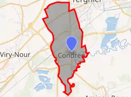 | |
 Condren  Condren | |
| Coordinates: 49°37′55″N 3°16′54″E | |
| Country | France |
| Region | Hauts-de-France |
| Department | Aisne |
| Arrondissement | Laon |
| Canton | Chauny |
| Intercommunality | CA Chauny Tergnier La Fère |
| Government | |
| • Mayor (2020–2026) | Claude Florin[1] |
| Area 1 | 5.58 km2 (2.15 sq mi) |
| Population | 708 |
| • Density | 130/km2 (330/sq mi) |
| Time zone | UTC+01:00 (CET) |
| • Summer (DST) | UTC+02:00 (CEST) |
| INSEE/Postal code | 02212 /02700 |
| Elevation | 44–71 m (144–233 ft) (avg. 51 m or 167 ft) |
| 1 French Land Register data, which excludes lakes, ponds, glaciers > 1 km2 (0.386 sq mi or 247 acres) and river estuaries. | |
Population
| Year | Pop. | ±% |
|---|---|---|
| 1962 | 571 | — |
| 1968 | 566 | −0.9% |
| 1975 | 558 | −1.4% |
| 1982 | 732 | +31.2% |
| 1990 | 725 | −1.0% |
| 1999 | 686 | −5.4% |
| 2008 | 712 | +3.8% |
See also
References
- "Répertoire national des élus: les maires". data.gouv.fr, Plateforme ouverte des données publiques françaises (in French). 9 August 2021.
- "Populations légales 2019". The National Institute of Statistics and Economic Studies. 29 December 2021.
| Wikimedia Commons has media related to Condren. |
This article is issued from Wikipedia. The text is licensed under Creative Commons - Attribution - Sharealike. Additional terms may apply for the media files.