Lor, Aisne
Lor (French pronunciation: [lɔʁ]) is a commune in the Aisne department in Hauts-de-France in northern France. It is around 30 km north of Reims.
Lor | |
|---|---|
_mairie-%C3%A9cole.JPG.webp) The town hall and school of Lor | |
Location of Lor 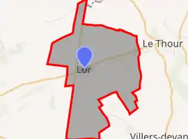 | |
 Lor  Lor | |
| Coordinates: 49°31′53″N 4°03′01″E | |
| Country | France |
| Region | Hauts-de-France |
| Department | Aisne |
| Arrondissement | Laon |
| Canton | Guignicourt |
| Intercommunality | Champagne Picarde |
| Government | |
| • Mayor (2020–2026) | Didier Feron[1] |
| Area 1 | 8.87 km2 (3.42 sq mi) |
| Population | 138 |
| • Density | 16/km2 (40/sq mi) |
| Time zone | UTC+01:00 (CET) |
| • Summer (DST) | UTC+02:00 (CEST) |
| INSEE/Postal code | 02440 /02190 |
| Elevation | 72–130 m (236–427 ft) (avg. 86 m or 282 ft) |
| 1 French Land Register data, which excludes lakes, ponds, glaciers > 1 km2 (0.386 sq mi or 247 acres) and river estuaries. | |
Population
| Year | Pop. | ±% |
|---|---|---|
| 1962 | 148 | — |
| 1968 | 143 | −3.4% |
| 1975 | 135 | −5.6% |
| 1982 | 113 | −16.3% |
| 1990 | 111 | −1.8% |
| 1999 | 122 | +9.9% |
| 2008 | 142 | +16.4% |
See also
References
- "Répertoire national des élus: les maires". data.gouv.fr, Plateforme ouverte des données publiques françaises (in French). 2 December 2020.
- "Populations légales 2019". The National Institute of Statistics and Economic Studies. 29 December 2021.
| Wikimedia Commons has media related to Lor. |
This article is issued from Wikipedia. The text is licensed under Creative Commons - Attribution - Sharealike. Additional terms may apply for the media files.