Lanchy
Lanchy (French pronunciation: [lɑ̃ʃi]) is a commune in the Aisne department in Hauts-de-France in northern France.
Lanchy | |
|---|---|
_mairie-%C3%A9cole.JPG.webp) The town hall and school of Lanchy | |
Location of Lanchy 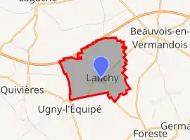 | |
 Lanchy  Lanchy | |
| Coordinates: 49°49′38″N 3°04′35″E | |
| Country | France |
| Region | Hauts-de-France |
| Department | Aisne |
| Arrondissement | Saint-Quentin |
| Canton | Saint-Quentin-1 |
| Intercommunality | Pays du Vermandois |
| Government | |
| • Mayor (2020–2026) | Xavier de Romance[1] |
| Area 1 | 3.69 km2 (1.42 sq mi) |
| Population | 37 |
| • Density | 10/km2 (26/sq mi) |
| Time zone | UTC+01:00 (CET) |
| • Summer (DST) | UTC+02:00 (CEST) |
| INSEE/Postal code | 02402 /02590 |
| Elevation | 84–94 m (276–308 ft) (avg. 98 m or 322 ft) |
| 1 French Land Register data, which excludes lakes, ponds, glaciers > 1 km2 (0.386 sq mi or 247 acres) and river estuaries. | |
Population
| Year | Pop. | ±% |
|---|---|---|
| 1962 | 66 | — |
| 1968 | 68 | +3.0% |
| 1975 | 60 | −11.8% |
| 1982 | 53 | −11.7% |
| 1990 | 54 | +1.9% |
| 1999 | 63 | +16.7% |
| 2008 | 54 | −14.3% |
See also
References
- "Répertoire national des élus: les maires". data.gouv.fr, Plateforme ouverte des données publiques françaises (in French). 2 December 2020.
- "Populations légales 2019". The National Institute of Statistics and Economic Studies. 29 December 2021.
| Wikimedia Commons has media related to Lanchy. |
This article is issued from Wikipedia. The text is licensed under Creative Commons - Attribution - Sharealike. Additional terms may apply for the media files.