Tupigny
Tupigny (French pronunciation: [typiɲi]) is a commune in the Aisne department in Hauts-de-France in northern France.
Tupigny | |
|---|---|
 The church of Tupigny | |
Location of Tupigny 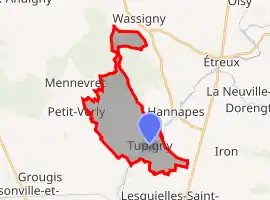 | |
 Tupigny  Tupigny | |
| Coordinates: 49°57′28″N 3°36′30″E | |
| Country | France |
| Region | Hauts-de-France |
| Department | Aisne |
| Arrondissement | Vervins |
| Canton | Guise |
| Government | |
| • Mayor (2020–2026) | Jean-Luc Egret[1] |
| Area 1 | 12.84 km2 (4.96 sq mi) |
| Population | 328 |
| • Density | 26/km2 (66/sq mi) |
| Time zone | UTC+01:00 (CET) |
| • Summer (DST) | UTC+02:00 (CEST) |
| INSEE/Postal code | 02753 /02120 |
| Elevation | 95–178 m (312–584 ft) (avg. 125 m or 410 ft) |
| 1 French Land Register data, which excludes lakes, ponds, glaciers > 1 km2 (0.386 sq mi or 247 acres) and river estuaries. | |
Population
| Year | Pop. | ±% |
|---|---|---|
| 1962 | 450 | — |
| 1968 | 436 | −3.1% |
| 1975 | 381 | −12.6% |
| 1982 | 330 | −13.4% |
| 1990 | 348 | +5.5% |
| 1999 | 350 | +0.6% |
| 2008 | 361 | +3.1% |
See also
References
- "Répertoire national des élus: les maires". data.gouv.fr, Plateforme ouverte des données publiques françaises (in French). 2 December 2020.
- "Populations légales 2019". The National Institute of Statistics and Economic Studies. 29 December 2021.
| Wikimedia Commons has media related to Tupigny. |
This article is issued from Wikipedia. The text is licensed under Creative Commons - Attribution - Sharealike. Additional terms may apply for the media files.